cycling

Fossils

I’m laying on my bed here in the John Day country — in fact I’m in Dayville, Oregon (population 193) at the Fish House Inn, a comfortable country house converted into a little inn and RV park, all with a rather incongruous nautical theme.  I just ate half a pizza with the owner Mike and his dog Zander, a giant golden retriever who chased our crusts across the lawn.  The pizza was made next door at a roadhouse by a couple of guys who look like they might be veterans and/or hunters (at least if the amount of camo they wore was any indication.)  The sign out front said “Espresso.  Never forget.”  The second sentiment surely relates to 9/11 or something right?  I thought it unwise to reassure them that I could never. forget. espresso.
monument
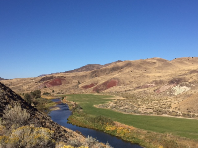
John Day fossil beds national monument — the red hills are due to some kind of volcanic deposit.

This beautiful country is the kind of place where you must allow things to happen to you.  Eight miles back up the road I made my best decision of the day and turned off US 26 to visit the John Day Fossil Beds National Monument.  This monument protects one of the most important paleontological sites in North America — a swath of country rich in diverse biological history (it was a jungle, then a woodland, then a savannah, then a high desert, all in the last 40 million years) and volcanic activity (it was repeatedly and often suddenly buried in layers of ash and hot mud which flash-preserved entire ecosystems in stone.) Due to its age, there are no dinosaurs here.  Rather, this place entombs layers of dead mammals:  a medium-sized North American elephant, a tapir so large it looks like a rhino, a large-tusked pig, a giant bear/cat sort of thing whose branch on the tree of life evidently dead-ended.  There is also a rich history of plants:  bananas, tea trees, avocados, giant oaks, palm trees — all grew wild in eastern Oregon in the deep past.

While I was thinking about all of this in the excellent monument visitors center, I was approached by an affable dude named Jimi (“Like Hendrix”) who asked me all about my trip and where I was headed.  It turns out that he and his son cycled throughout New Zealand last year — they immediately invited me to spend the night at their house when I passed through Prairie City, Oregon.  I thanked them and told them I’d see them tomorrow.  Sometimes good things just happen.  What’s important and sometimes not so easy for me is to remain open to these signs of hospitality.
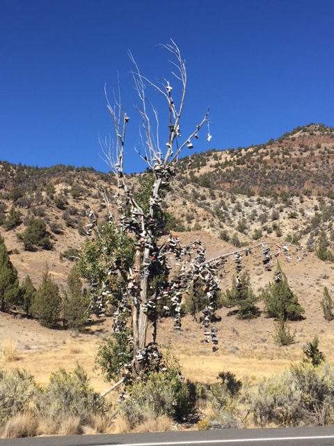
shoetree
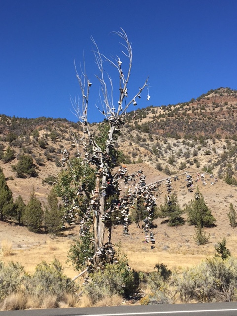
The shoetree, between Mitchell and Dayville, Oregon.  WTF

Maybe the uptick in human kindness has something to do with the harshness of the land though which I passed today.  It’s as if the difficulty and directness of life in a place like this needs to be compensated by a greater sense of humanity.    I first noticed this back in Mitchell,  a tiny town which served as my lunch stop.  Mitchell is a crusty speck of a place in the middle of a truly huge and forbidding wilderness.  The only business open in town was a little cafe serving lunch to a small crowd of local people.  “It’s taco Tuesday” I was told by a genuinely happy local, sitting at the bar.  It was.  I ate my large white-people taco with vigor.  Outside, a barely functioning pickup truck pulled up with a tank in the bed which I soon detected was used for servicing rural septic tanks.  Its driver was a sun-baked man who appeared to be in his seventies and spoke almost exactly like Yosemite Sam.  He provided me an impromptu survey of the road ahead — especially the dangers of a stretch of road about 30 miles down where US 26 enters a deep canyon and visibility is limited.  I thanked him for the info, he seemed genuinely concerned for me, which felt good.  As it turned out the canyon in question was definitely a place for caution, but far worse (and totally unmentioned by the rustic gentleman) was the truly hellish climb out of town.  Known locally as the “Mitchell grade” it’s an eight-mile, 2500 foot climb out of the deep canyon in which the little town sits.  I climbed it in the intense sun, the taco dancing uneasily in my stomach.  I had to stop four times in what shade I could find under the scrawny pines to chug water and catch my breath.  At one stop I happened across a rather ominous (and perhaps politically dubious) historical marker, some five miles and a good 1500 feet above Mitchell.  It read:  W. W. Wheeler.  For whom Wheeler County was named.  First President of East Oregon Pioneer Assn.  Also US Mail carrier from The Dalles to Canyon City.  Was attacked near this spot by Indians.  Was wounded, mail looted and coach destroyed.  Sept 7 1866.  Memorial erected by East Oregon Pioneers.

Just before lunch I’d descended from the high pass of the Ochoco  Mountains down down down into the town.  Racing down the canyon side, I knew that the land’s revenge was coming at me later (especially since I look at a climbing profile of the ride I’m taking each day.)  However, it’s always been difficult for me to imagine a worse sensation when in the arms of a better one, so the fact that I’d actually have to climb this hill’s evil twin was a mere abstraction as I whizzed down from the high pass of the Ochocos.
pre-mitchell
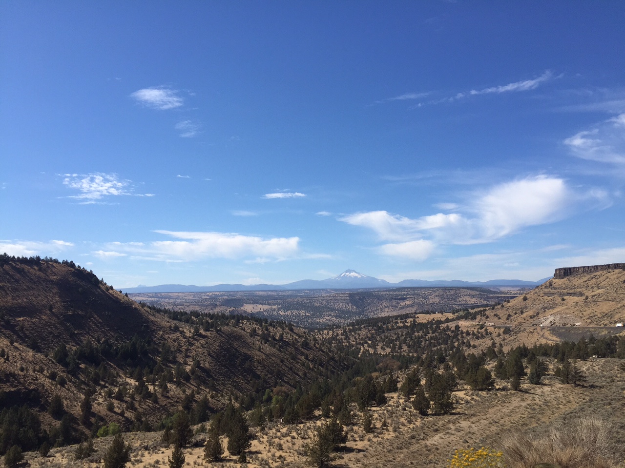
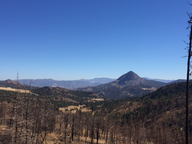
Looking down toward the Mitchell gulch. In the distance are the mountains I’d soon re-ascend.  Note the burned forest — that was from a year ago.

Of course I’d had to climb that pass too.  Yes, there were two long climbs today.  Departing Prineville, I ascended gradually over a 20 mile grade through the Ochoco National Forest up the side of the mountain range of the same name (for those counting that’s 2 mountain ranges down out of 4 on this trip — not bad!)  The climb was long and steady, but aside from a little bit of a headwind at first, it wasn’t that bad.  The odd thing about the climb was the smell — for much of the way I could smell nothing but death.  While roadkill is a cyclist’s ever-present companion in wild areas, I have to say that today was way over the top.  An incomplete census of animals (dead and quick) observed today:  deer (dead, many), turkey (alive, one, seemed lost), skunk and raccoon (dead, countless), rattlesnake (live, one eek!), grouse (I think, live, a gaggle), cattle (live, many many.)

it’s time for bed now, after one of the tougher days on this trip.  Eighty-nine miles, over 5200 feet of climbing.  Tomorrow is a light day of only about 35 miles.  I plan to do most of it early and to use the day to check in with work and then rendezvous with the folks from Prairie City.  I’ll be glad for the (relative) rest.
cycling

What goes down …

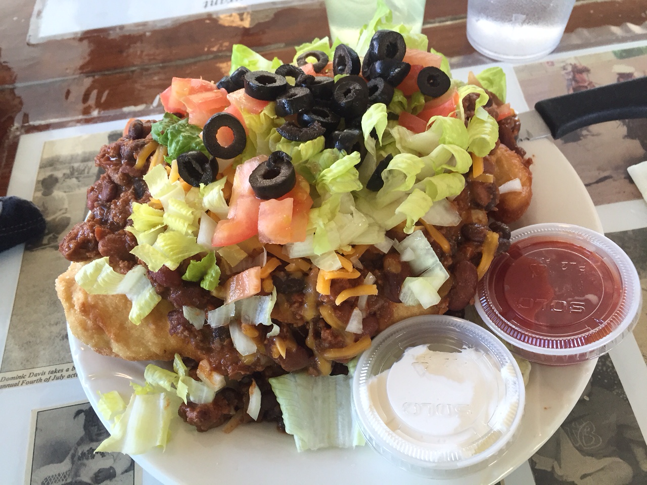
I’m really tired right now.  95 miles.  3500 feet of climbing.  My body has had enough for one day, despite being fed a constant train of high energy foods: pancakes, tacos, granola bars and the famous “Indian taco” — a huge slab of fry-bread covered in somewhat dubious taco ingredients.

indiantaco
This is an Indian Taco. Ohboy.

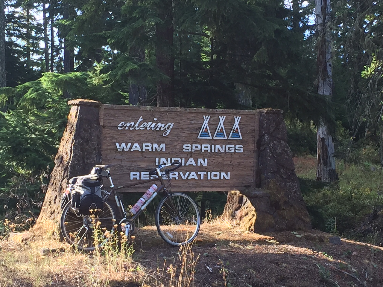
Fry-bread is a Native American delicacy, and indeed I spent most of the morning on the Warm Springs reservation, crossing its international border after a rather freezing hour of fighting through the exit to the Cascade mountains.  Leaving Mount Hood would seem like a pure exercise in coasting downhill, but to the east one must traverse two more mini-passes, each cresting at about 4000 feet, until the real descent begins.  After that everything changed very quickly.  Soon after crossing the 45th parallel (“half way between the North Pole and the Equator” said the sign in the middle of nowhere) the trees began to thin, and a great sweep of grasslands opened up.  The road ran rail straight for over twenty miles, running though cold and windy rangeland that had recently burned, before plunging dramatically down into the canyon of the Deschutes River to the main reservation town of Warm Springs.

warmsprings
Tribal boundary sign.

It is a fact of cycling that what goes down must come up, and I contemplated this while back on US 26, post-fry bread.  Subaru-driving fishermen (most of whom were of a certain age and reminded me of my dad or uncle) waded in the river casting for trout.  Pale yellow moths of some sort formed clouds over the sidewaters and bushes.  And then the hill.  It was a brutal, rude hill, made worse by the fact that it was now after mid-day and the sun was beating down.  It went on and on and on, climbing the sides of the canyon I had only recently descended until it finally deposited me back up on the arid plateau from whence I’d came.

looking back toward the canyon of the Deschutes.

I was beginning to feel as though biting off such a long day of riding was a horrible idea.  How would I ever get this done?  I’d planned at least two other days of this magnitude on this trip … could I not handle this amount of riding and terrain?  Several things helped:  first, mind-games.  Looking at the odometer on my bike computer makes the miles go slower.  But I like looking at the odometer on my bike computer dammit!  So I make deals with myself … no looking until you’re over the next hill!  Also, singing helps.  Or OM-ing (like in a yoga class.).  This seems to calm me, to make me less antsy in the saddle, and to expand my breathing to its full range.  (There’s no one around to hear either.)  If all else fails, bribe:  you can eat a granola bar at that crossroads across the valley.  All of these things make me feel rather like an infant, but if the shoe fits …?

jefferson

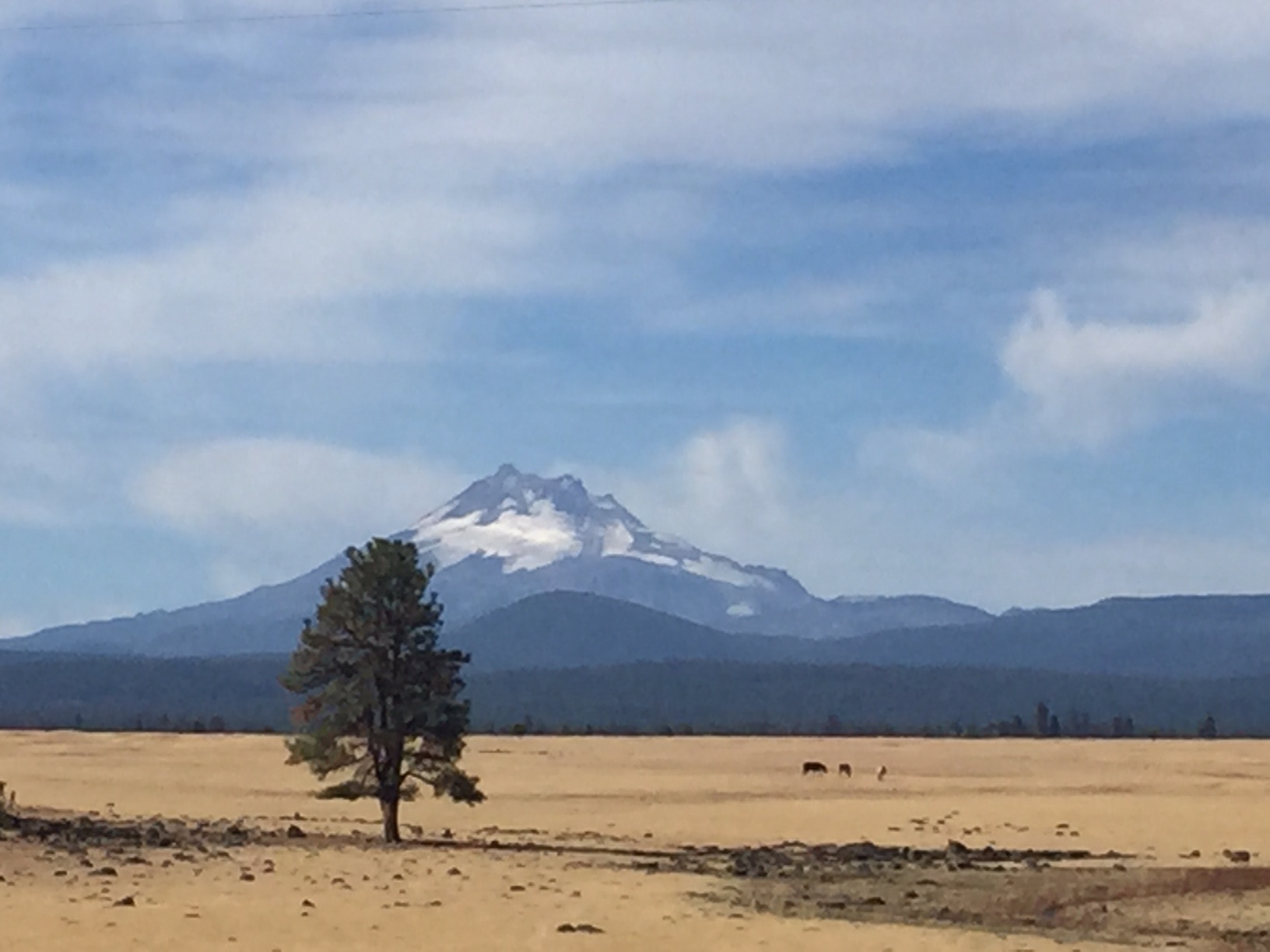
In the late afternoon, a great tailwind picked me up and practically blew me from Madras, Oregon (that’s MAD-ras!) all the way across the stunning Crooked River National Grassland and into the hay growing valley of Prineville.  It was late afternoon and warm, though the signs of autumn where there to be seen.  Huge murmurations of birds danced low over the fields.  The hay was being brought in and stacked in piles as high as a six story building.  The light began to slant, in that way that makes everything seem older and beautiful.

Though my legs might beg to differ, I think I could get used to this.

cycling

Mount Hood

For new readers, a bit about what this blog is about:  my company (Automattic) holds its annual meetup in Utah again this year, and some time last spring I made it my goal to get there on two wheels. This is my first post about that trip — though it may include various other personal ramblings too.  To wit:

There was a general kerfuffle recently when the author Jonathan Franzen revealed that his one-time desire to have a child had been more or less destroyed by none other than his editor, and that Franzen now says he allowed himself to be convinced that as a gifted writer, raising a kid was not the best use of his energies. Many people judged this revelation to be either egotistical (fair point) or just plain wrong (why can’t people raising children produce great art too — I certainly know of some who do!) But I think I get where he’s coming from . Of course I’m no artist. That said, I do believe that all humans — regardless of whether Oprah has promoted one of their novels — are given the ability to radically engage the world around us, and if children are not in the picture, that somehow becomes more possible, though clearly at a cost. The act of breaking away from daily life which in my case right now means riding my bike a long way, or at other times has meant going to live in the woods for a couple years, or flying half-way around the world to live in India for a while — these sorts of things are occasions and opportunities to throw oneself open to experience, to other people, to transformation:  in short, adventure. So while I totally cop to shirking my genetic duty to the species and missing out on the sacred experience that is having children (though I guess not being attracted to women had some sway on all that) I find joy and opportunity in this other, different kind of doing: I get to ride my bike 950 miles over four mountain ranges! Hell ya!

***

I had intended on starting out quite early this morning to leave Portland, Oregon, mile zero of my trip.  However some combination of that city’s excellent beer, a wonderful conversation with my friend Leah and a certain amount of difficulty getting to sleep the night before meant that I didn’t really get going until about 9:30am. Not that it mattered really since my day’s ride was relatively short (just under 60 miles as compared to a trip average of about 77) and I thought it wise to ease into the rhythm and exertions of what I was about to do over the next two weeks. After all this is not a race — if one could even in theory have a race with oneself.

me_start
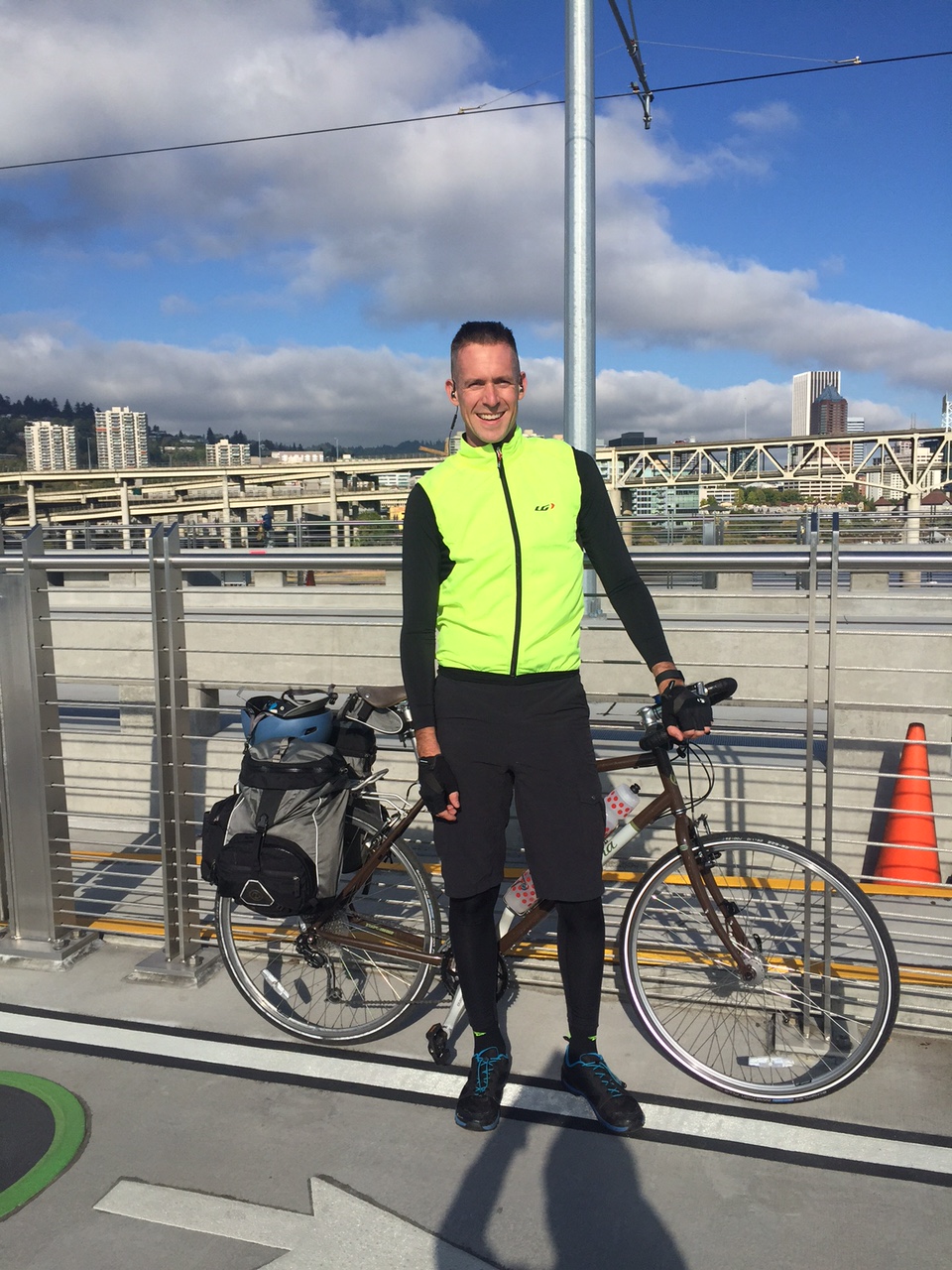
Starting out.  Standing on the best bicycle bridge in the world.  Its full inscribed name is “Tillicum Crossing, Bridge of the People.”

Portland said goodbye in its slacker fist-bump sort of way. Everywhere I looked as I pedaled away from the downtown area there were locals relaxing, doing nothing … slowly. Sidewalk brunch places overflowed. Hipsters on 80s bicycles lolled this way and that.  Traversing the Willamette river on the stupendous new bike bridge (a structure opened just this summer which accommodates all modes of transport except cars) I was funneled into one of Portland’s many cycle paths — segregated superhighways which circulate bikes around town in a way that actually works for the people who use them. You can get nearly anywhere on a bike path in Portland and its suburbs — including out of town, as it turns out.

portland_trail
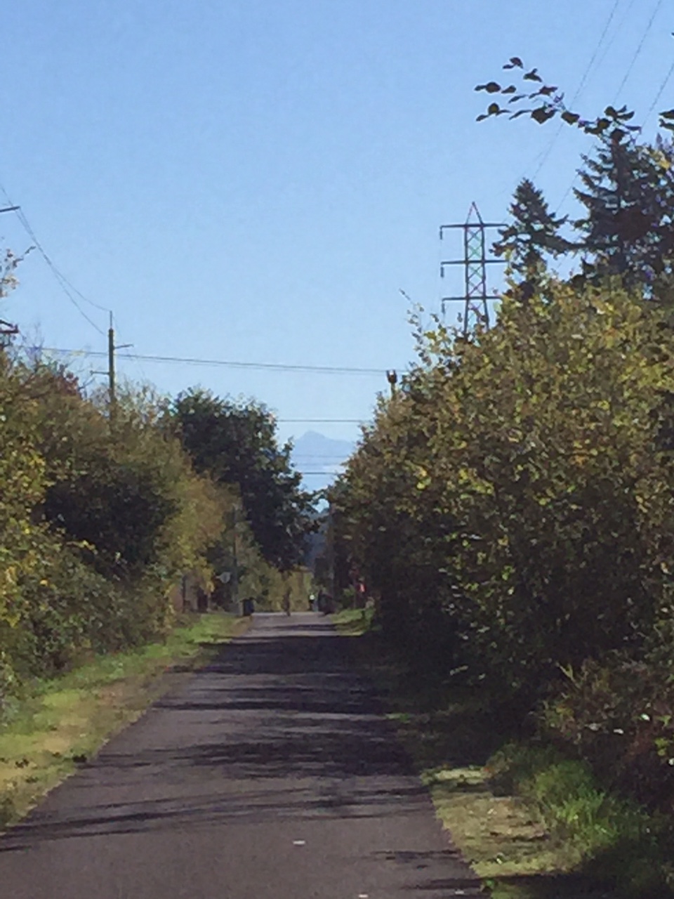
A suburban Portland bike path.  Note the shadow of Mount Doom Hood perfectly framed by the path.  A portent.

At Boring, Oregon (seemingly well-named) it was time to leave the trail and join US 26, my probable road-home for the next four days. In exurban Portland, 26 is a messy six lane highway passing through the town of Sandy and thence up into the forests around Mount Hood and up its broad flanks. I’d be spending the night at the ski-town of Government Camp (incidentally the site for most of the exterior shots in Kubrick’s the Shining — gulp.)  But as I approached the base of the mountain, the close-in forest kept me wondering when the real climbing for the day would start — my route promised over 5,000 feet of climbing on the day, and I was sure I’d done less than 1,500.

hood_26
Mt. Hood reveals itself.

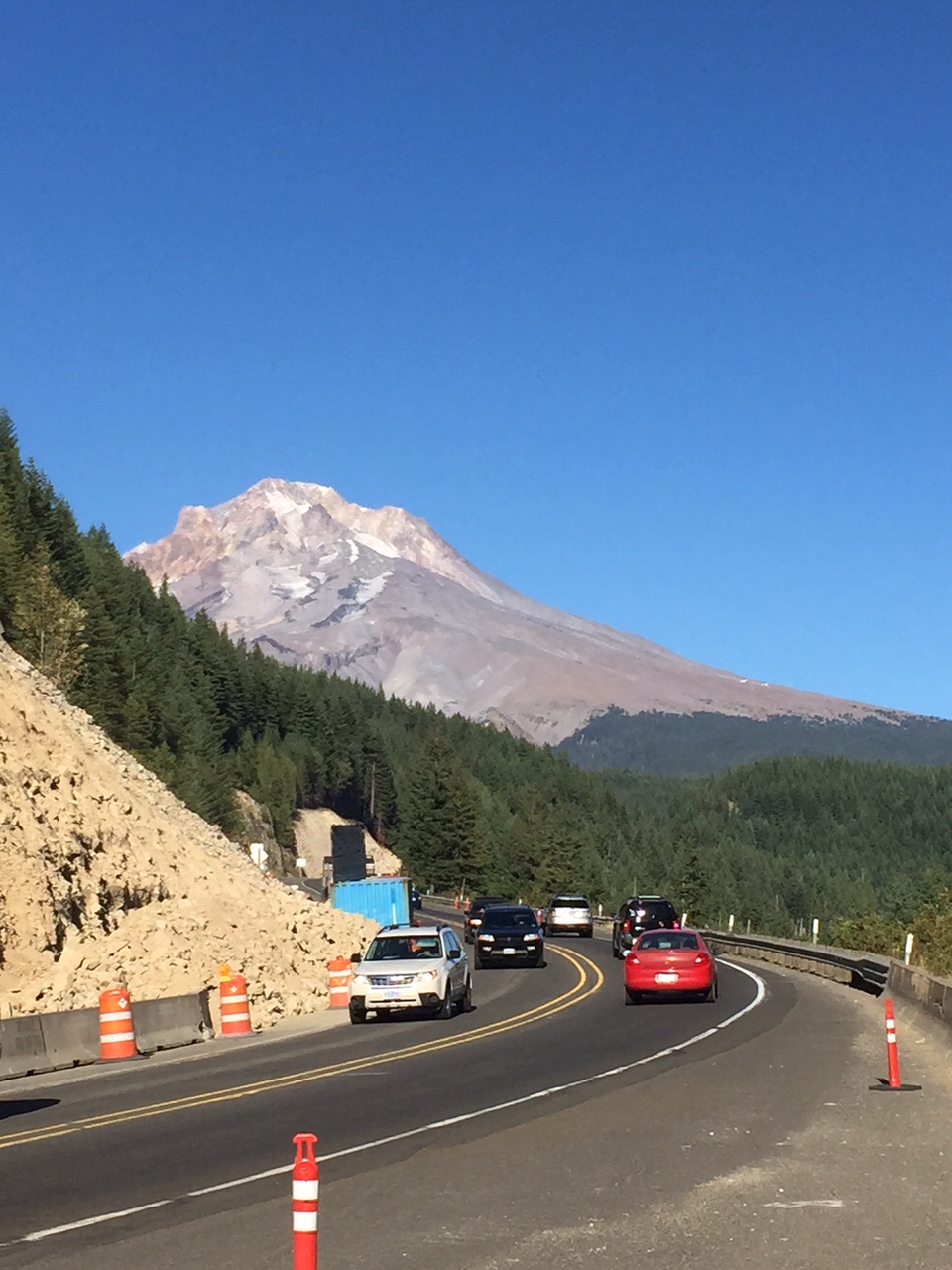
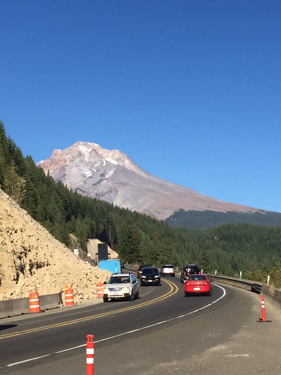
I needn’t have worried.  The tilt started just after the village of Rhododendron, where I’d stopped for break and chatted with a couple of young women running the local cafe. “Yah there’s a hill,” one of them said, laughing. “It’s not too bad though. Just steady.” That sounded okay. “Whenever I see a bike up there though I think they’re crazy.” That sounded decidedly worse. During the climb, along with mile markers (which I passed with excruciating slowness) there were also altitude indicators. 1500 feet. 2000 feet. 2500 feet. Then the signage vanished at the beginning of a 10-mile blast/construction zone, and so I found myself trying to guess how far and high I’d climbed. Cars whizzed by. I sweated. The road’s broad shoulder was there for me to chug slowly up, except when it was occupied by construction vehicles and I had to be inventive, making runs uphill timed to pauses in traffic. Then all of a sudden Mount Hood at its most naked reared up ahead of me around a bend, much much larger than I’d last seen it before the trees encroached.

I turned my brain off and made it to the top.

cycling

Warm Up

This past weekend I undertook my final warm-up ride before my big trip from PDX->SLC begins in less than a week. I tried to make it as realistic as possible — loaded bike, ~ 90 mile route.  I even brought my technology along and worked for the day from Mercer Island, about 12 miles into the ride.  Roughly speaking, my route took me from my house in North Seattle, down the shore of Lake Washington to the I90 floating bridge to Mercer Island, a somewhat one-percent-y suburban islet between Bellevue and Seattle.  After working for 5-6 hours or so at a rather cacophonous Starbucks, I saddled up again and continued east towards the growing Cascades, passing through about 10 more miles of solid suburbs along a series of poorly-connected bike paths, until at last the hills grew into full foothills, the forest encroached and finally swallowed the mini-malls and I climbed toward the former resource towns/current-exurbs of Snoqualmie and North Bend.  All except the very youthful may know these places as the backdrops for the epic but brief David Lynch series Twin Peaks.  I know them as places with very poor bicycle signage … I ended up at one point riding across a private golf course to get to where I was going.

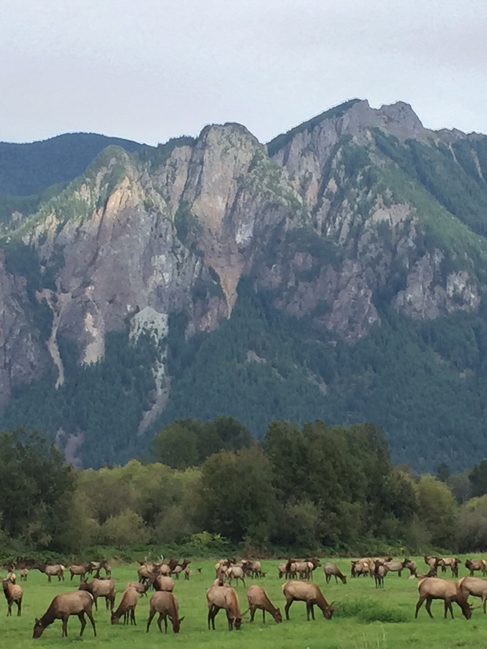
But it was worth it, since at the far end of North Bend I was greeted by a spectacular herd of elk grazing in the shadow of Mt. Si:

IMG_0282

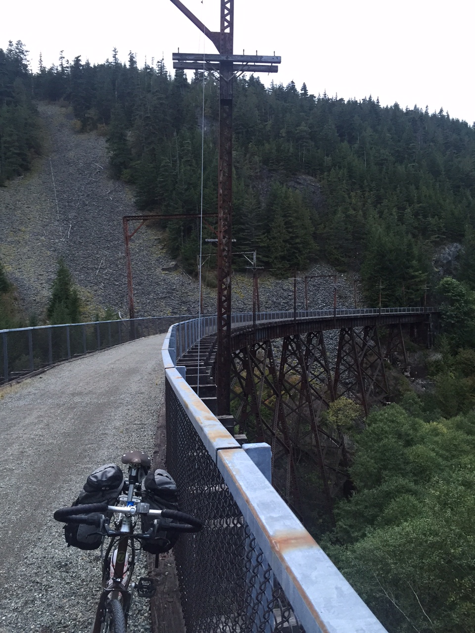
It was mating season, or at least that’s what I was able to conclude by the startling array of noises emanating from the male elk as they cantered around the open field.  Several motorists stood outside of their cars at the side of the backroad next to the meadow, and I stopped my bike to join them, chatting with an amiable wireless-technology salesman as we watched the live-action nature film unfold in front of us.  I soon realized it was getting late … and I had a mountain pass to climb and I was a good 1.5 hours behind schedule.  So I left the elk, meadow and towns behind and headed for the real mountains.  My next passage was up a steep and surprisingly busy spur road to and several miles back into the mountains to the trail head at Iron Horse State Park Trail.  This state park is possibly the most unusual in the country — it’s over 150 miles long from end to end, but is at no point wider than about 100 yards.  It’s composed entirely of a former railroad right-of-way of the old Milwaukee Road that traversed Snoqualmie pass and connected the Columbia Basin and Central Washington with Seattle and the Ocean.  Now it’s an awesome bike/horse trail which winds up the pass at a gentle grade over trestles and through tunnels to the top of the pass.

IMG_0284

I climbed and climbed, seeing almost no one for miles as I wound back into the gray mountains.  Far below I could see the interstate chugging up the valley floor, a ribbon of red and white.  The air grew cold [note to self:  bring warm clothes on the trip], and the shade of the trees darkened and then became nearly black as the road dipped and wound up and up. It was quite dark when I reached my penultimate goal — the 2.5 mile tunnel that would take me through a mountain and out the other side to Snoqualmie Pass, where I would stay the night.  I entered the tunnel, thinking of nothing so much as the back door to Moria in Fellowship, and pedaled in the dripping blackness over an even surface illuminated by my lamp and pocked by many icy puddles fed by drips from above.  After a seemingly too-long time, I emerged at the far side, shivering but happy.  It was deeply dark.

I passed the night at a rather run-down motel at the top of the 3,000 foot pass which served the ski area during the season and truckers during the off-season.  I checked zendesk, but fell asleep almost immediately (mid-ticket.)

The next day I continued on the trail:  down this time, through the rest of the mountain range and 30-miles on to the edge of the steppes of Central Washington.  I followed the same railway road, straight east now, as it punched through the mountains and arrived at Cle Elum, the little town where Matt (my partner) and I would attend a wedding that afternoon.  He had been gracious enough to bring a change of clothes for me and would also be around to make sure both of us and my bike made it back to Seattle the following day.

So — mission accomplished!  95 miles, one mountain pass, ~5000 ft climbing, no mechanical or other problems … I feel ready to do this!

cycling

What’s in my (saddle) bag?

It’s two weeks before my departure to Utah, and my body feels like it will likely be in sufficiently good condition to handle the rigors of the 13 or so days of pedaling over four mountain ranges I’m about tackle  But there are other things to get ready before I depart, the most important of which are probably the bike itself (of which more in a later post) and then all of the stuff I need to take with me either on my body, on my bike or in my saddle bags.  So in the tradition of a certain CEO, I thought I’d provide a look at what exactly I’ll be dragging around with me on this voyage. In what follows I’ve tried to account for all of the objects I’ll be transporting — everything except my body and the bicycle.  The lone exception — I think —  is the bicycle pump I use, which happens to be mounted to the frame.  So without further ado, here’s what’s coming with me.

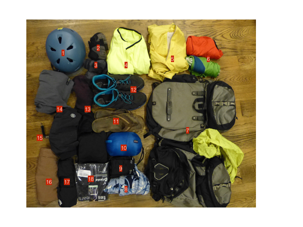
Mostly on my body or bike:

bikepacking.001

  1. Bern Brentwood Zip Mold helmet with visor (XXL — apparently my head is massive.)
  2. bike gloves
  3. Novara quick-dry bike socks
  4. Louis Garneau Nova riding vest
  5. Novara cycling rain jacket
  6. jerseys
  7. Novara panniers with rain fly
  8. swimming trunks (I’m going to some hot springs, and I jump in rivers)
  9. lightweight underwear
  10. Patagonia lightweight down hoody jacket (cold mornings, > 5000 ft passes)
  11. flipflops
  12. Shimano CT71 click’r bike shoes
  13. bike hat, warm hat
  14. 2 pairs bike shorts
  15. FitBit surge
  16. “town” pants for days off (Bluffworks)
  17. Gym shorts (to sleep in)
  18. Tesla under-layer compression shirts and pants

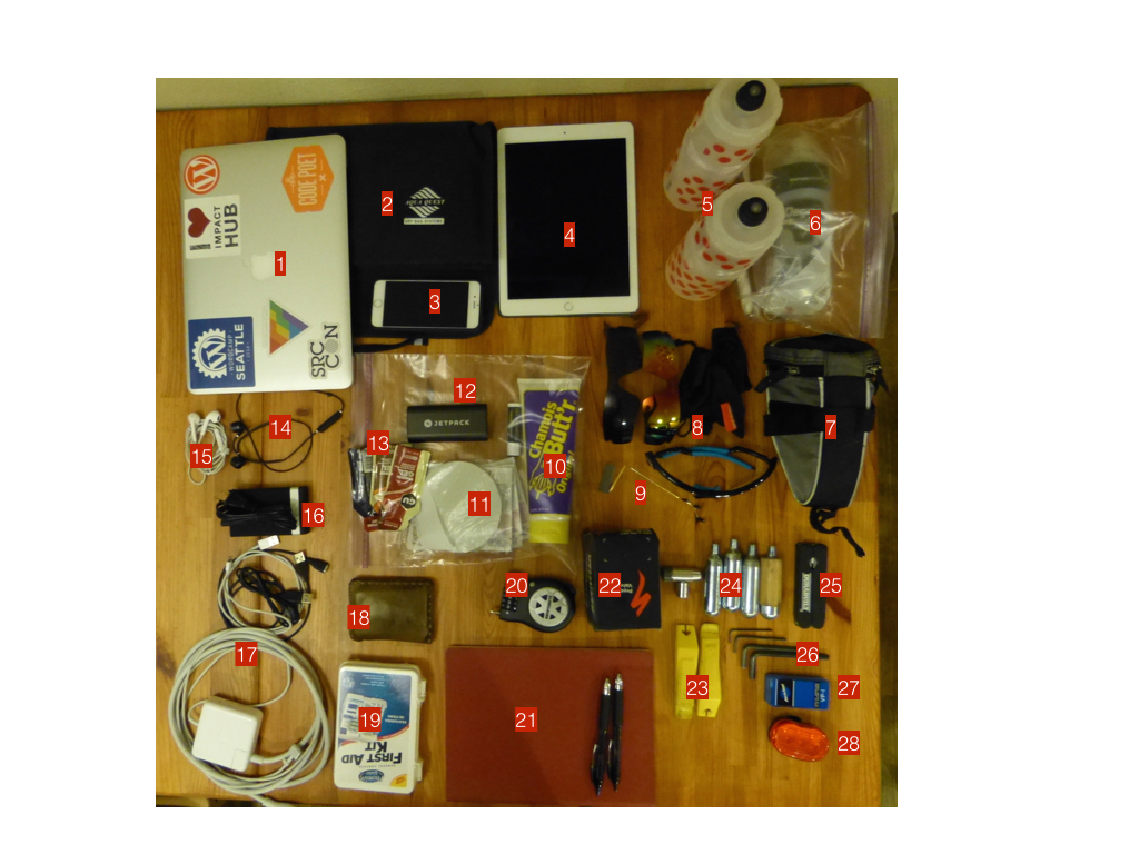
Mostly not on my body:

bikepacking.002

  1. 13” MacBook Pro (I’m going to work for 4 of the days I’m on the road.)
  2. Aquaquest dry bag for MBP and iPad — in case my bag falls in a river
  3. iPhone 6
  4. iPad Air 2
  5. Purist water bottles
  6. Toiletries
  7. under-seat tool case
  8. Rivbos removable-lens cycling glasses, bag, extra lenses
  9. take-a-look rear-view mirror (attaches to glasses — extremely important safety item)
  10. Chamois butt’r (don’t ask)
  11. laundry kit (for doing laundry in the sink)
  12. Jetpack charger
  13. Gu emergency nutrition (prevents bonking)
  14. Havit bluetooth earbuds
  15. Apple earbuds (for when the Havit ones are charging)
  16. Zilu 5-usb charger
  17. power cords and chargers etc
  18. wallet
  19. first-aid kit
  20. kryptonite light-weight lock
  21. journal, pens
  22. spare tubes
  23. tire irons
  24. Portland Design Works shiny object CO2 inflator and cartridges
  25. multi-tool
  26. allen keys
  27. patch kit
  28. rear light (not going to be riding at night, but just in case)

Actually pulling out all of this gear and listing it makes me aware of how much I’m planning to take … this is probably a good thing, since I think that over-packing is a much bigger threat than under-packing for these sorts of trips.  Though I’ll be in some remote places, I have to remember that the high plains of Oregon and Idaho are a far cry from the ends of the earth.  Rather, my packing philosophy is based around avoiding manageable bike-disasters (which really equates to dealing with flats quickly), staying warm and being able to work and stay in contact from the road.  One thing I don’t have to worry about is camping — and that’s because I won’t be doing any.  Deciding to “credit-card” it (ie:  sleep in motels of various kinds) subtracts a lot of weight from the bicycle — no tent, sleeping bag and the like.

cycling

Training, fire and wind

The idea that in less than four weeks I’ll be on the road in Oregon on my way to Idaho and Utah still seems like a fantasy, but here’s a brief update about my recent training and preparations:

The past few weeks have been all about getting my body and bicycle ready for the rigors of a long trip.  I’ve fallen a few minutes short of my planned training times a couple of the past few weeks, but I still feel good about progress.  Planned weeks of 360, 480 and 540 minutes came in at 347, 490 and 450 — in other words, close, great and not really that close.  On the other hand my long day so far is 360 minutes, or 6 hours and over 1500 feet of climbing.  This pretty accurately simulates what an average day on the road for me will be like, and while I was certain sore at the end of the day, I wasn’t devastated.  That’s a good sign right?

The long day in question was a trip with my friend Brooke to the Bicycle Festival, fun ride and overnight party in the Cascade mountain town of Snoqualmie, Washington.  Departing from Seattle at about 7am, I wound my way up the shores of Lake Washington under a sunrise stained deep red by the hanging smoke from a profusion of fires burning in the central part of Washington and Oregon right now (more on them later.)  The smoke would stay with us all day as we wound up through the bucolic towns north of Seattle, and then back down through the tranquil valley of the Snoqualmie river toward the first slopes of the cascades, and then finally up a giant lurching hill past Snoqualmie Falls (for those of a certain age, that’s the one in Twin Peaks) and thence to the festival, which took place under the smoky shadow of impressive Mount Si in a rather unimpressive field.  The scenery, along with the good music, food trucks and general lack of sobriety made for a good night, however.

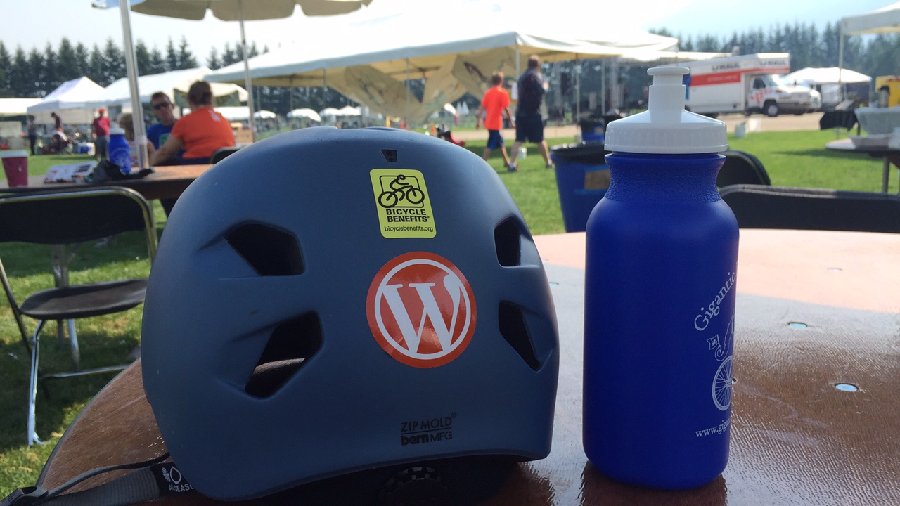
nerd helmet at Bicycle Festical
nerd helmet at Bicycle Festival

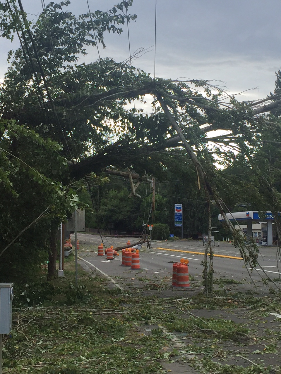
Being out on my bike so often over the past few weeks has reconnected me with the powers of nature.  The other day here in Seattle — after a very long expanse of dry, hot weather — we experienced a drenching rain and a rather violent, unexpected, wind storm.  The tail wind that propelled me north at a rapid clip up one lobe of my usual training loop became a stiff headwind on my way back.  This recalled a 2006 bike tour during which my brother and I battled a brutal coastal headwind for 4 days down the Oregon coast until mercifully, and all at once, the air currents wheeled around and blew us practically all the way to San Francisco.  This might happen on my upcoming tour — I have no way of knowing for sure, although I believe that the prevailing autumnal winds in the mountain/steppe through which I will ride come from the north and west, which should generally be to my benefit since I am bound south and east.

Turning to ride home from my training, I crossed a familiar large avenue only to see this:

IMG_0235

It was an excellent reminder, I thought, that we humans are not in charge of what the planet does when.

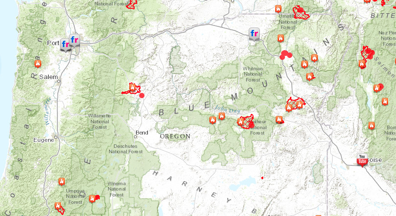
Frequently on my mind right now is the fact that there are three significant wildland fires burning more or less in the path I wish to take at the end of September.  The fires in question are represented by the three blotches closest to the center of this map:

Screen Shot 2015-09-01 at 12.04.45 AM

None of these fires has currently closed the road I wish to take, and many are slowly creeping along in far-flung areas away from the road.  But two of the three have crossed US highway 26 over many miles, which means that I will ride through a landscape of charred trees and earth.  While it’s true that the terrible fire season we’re having this year has thrown some of my plans into question, this is kind of meaningless when measured against the severe hardship, loss of property, injury and even death that this has caused in the lives of others.

Nature is nature, and we have to accept it — and this applies to the limits of my own body as much as it does to the terror of fire, or the power of wind.

cycling

Training for a two week tour

Getting physically ready for a long long cycle tour is important.  Not doing so can lead to many sorts of problems, particularly when you’re anywhere north of your 20s.  In 2006, when my younger brother and I biked from Seattle to San Francisco,  I distinctly remember that my little bro — then in his mid-20s — eschewed all training before the ride began.  He was saved only by his youth and the easy nature of the first few days, along with the prodigious amount of tacos and fry-bread he ate.

Getting physically ready for a tour seems to be mostly about getting your body used to sitting in a saddle for a large number of hours each day.  It’s secondarily about fitness and endurance, especially if you’re starting from a decent baseline of cardiovascular fitness.  For some — particularly those who are starting from a low level of weekly activity — it’s also about building the strength and endurance needed to cycle for many hours each day.  For me, it’s certainly a combination of these things, but since I’m starting at a reasonable place in terms of cardio conditioning, the most important aspect is certainly the first.

There are plenty of resources available all over the place which suggest various training schedules, and from these I wet ahead and adapted the following schedule for the last 6-7 weeks before the tour begins:

weeks_before_tour /long_ride_1 (mins) / long_ride_2 (mins) /total_time (mins)

7/90/120/360
6/120/150/480
5/150/180/540
4/120/0/240
3/180/210/660
2/180/270/690
1/*/*/minimal

So this week (t minus 7) I’m attempting two longer rides of 90 and 120 minutes (90 min ride accomplished, 120 min ride scheduled for Saturday.)  The week’s total riding time is 360 minutes, which means that I’ll need to continue riding an average of 30 minutes on the other days of the week.  Training peak happens two weeks before touring and will include 3 and 4.5 hour rides with an average of 45 minutes the other days.  The week immediately before the tour is a back-off week, allowing the body to recover prior to being hammered for a couple of weeks straight.

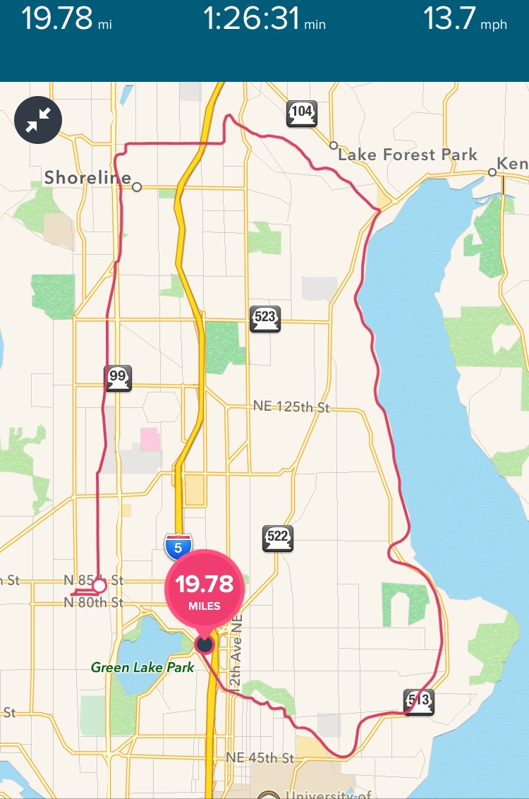
So far, this has been my go-to 90 minute training ride … it includes a pretty modest climb, and one fun downhill.

FullSizeRender

(You might notice that this route does not constitute a complete circuit — blame that on my tendency to stop off at a frozen yogurt place right around the location of the big black dot.)

I’ll provide more detail and updates on training as I go through it.

cycling

Saddle

When riding for a long time or for many days on end, it’s important to get a few things right.  One of those is to choose the right kind of saddle.  (And just a note here for the un-bicycley, it is saddle and not seat.).  Making a poor chose in this department can result in miles and hours of discomfort in the form of really bad pain and chaffing and other physical problems specific to men which I won’t go into here.  Paying top dollar for a good saddle is almost always worth it for anyone who will spend a significant amount of time riding, and I say this as someone who really isn’t a believer in always buying the “best” components.

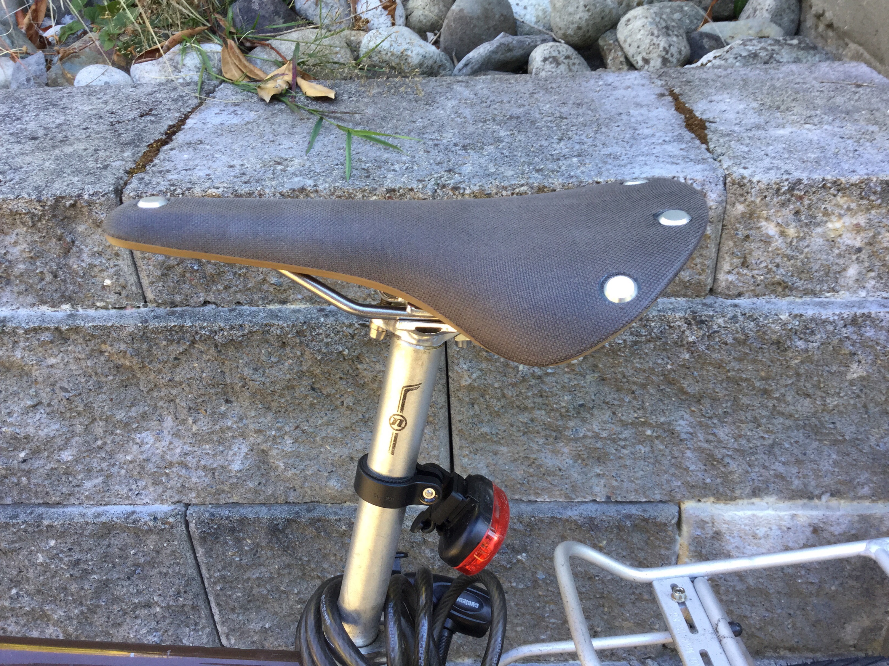
Here’s my new saddle, the Brooks Cambium C17.


I’ve long coveted one of Brooks traditional touring saddles, all of which are made of leather.  A leather saddle has the nearly unique characteristic of conforming to the shape of your body in the way that other saddles don’t.  The result is a ride that is way more comfortable over many miles and hours.  But what has always me back (aside from the significant price tag) is the fact that leather saddles are sensitive to weather, and can be damaged by repeated exposure to rain.  Given where I live and my level of dedication to keeping my bike dry (nil) owning one always seemed like a poor idea.  That’s why the C17 is so rad.  Same butt-conforming properties and comfort, but it’s made out of rubber and a denim-like fabric that render it waterproof.

I’ve been on this saddle for just over a week now, and have put perhaps 80-100 miles on it.  There’s a “break in” period of about 100 miles for these sorts of saddles, which means mine is just at the point of reaching its proper shape.  At first I thought the saddle felt harder than my previous synthetic one — my first couple of rides ended with more soreness and a bit of disappointment.  But after my last ride (just last night, 22 miles over 1.5 hours) I started to feel it.  I wasn’t sore at all, and I have a sense now when I get on the bike that there’s a sweet spot where my body just fits on the bike.  Later this week I’ll have the chance to try it out over a longer ride of perhaps 3 hours, but so far I’m very happy with this saddle.

cycling

Welcome

Welcome to this new blog, which is meant to document my cycling exploits, particularly my planned mega-adventure of cycling from Portland, Oregon to Park City, Utah.    There’s much to tell here — who I am, why I’m doing this particular ride, and what I’ve done before that would make me think this is a good idea, as well as a great deal of minutiae that I plan to include here for those who might be contemplating a similarly foolish but wonderful feat.  But to start with, here’s the one-minute version:

  • I work for a great company called Automattic (yes, the same one that runs this blogging platform.)  Each year, the entire company gather together somewhere in the world.  This year (and last) our gathering will happen in the middle part of October in Park City, Utah.  Instead of flying (yawn) I’ve decided to bicycle to the meeting this year.  I live in Seattle, Washington, but I’ll be starting the ride from down the road in Portland, Oregon.
  • I have a history of this sort of thing, having (for example) cycled down the west coast of the United States with my brother Seth a number of years ago.
  • Cycling long distances is awesome.  I think it could be something that far more people could do than do now.
  • My job is completely virtual — meaning I can do it from wherever I happen to be, given a suitable internet connection and my laptop.  Therefore, my plan is to do a certain amount of work from the road.

I’ve done a reasonable amount of thinking about the route I will take on this trip (more on that later of course — much more.)  But I plan to cross the entire state of Oregon and the southern (thick) part of Idaho, on my way down into the Salt Lake area and then up to Park City.  In the course of doing this, I will climb four mountain ranges (for the curious, that’s the Cascade, Ochoco, Blue and Wasatch ranges) and I will descend from three (all but the Wasatch.)  Though I have yet to count precisely, this ride should extend over more than 800 miles and involve well over 30,000 vertical feet of climbing.

So there you have it … welcome — and much much more to come.