cycling

River of Cloud

[XWA series home]

Day two of riding began — stiff, cold and faded. Lake Crescent shivered under a light but constant breeze. Storm King was wreathed in drizzly clouds. We packed slowly after a leisurely breakfast followed by very good instant coffee (thanks to Kelly) and a certain amount of sitting in our ultralight camp chairs, which we enjoyed but also thought we should probably use since we’d packed them. (The chairs, by the way, are a minor marvel. Weighing barely over one pound and packing down very small, they support even a 200-pounder like me, as long as they’re on a vaguely flat surface.)

Such were the distractions of the morning, but we were off finally before about 9:30 am. “I guess we are 9:30 people,” we said to each other on the way past Devil’s Punchbowl, a formation on the far northeast corner of Lake Crescent’s shore. Almost immediately we began to climb a ridge toward the day’s first challenge — the 26-mile Olympic Adventure Trail, a singletrack route across a shoulder of the Olympic Mountains between the lake and the Elwah River drainage, a few miles short of Port Angeles. The trail wound through what seemed like an endless series of forested valleys, clearcuts through switchbacks and fun descents. At times we had a broad view of the Straight of Juan de Fuca, Vancouver Island and Victoria. At one point we came around a tight turn and surprised a large group of adolescent bald eagles who propelled themselves over the cliff with thumping wings. The trail peaked and dove over several 500 foot ridges so that our total climb for the day already exceeded 3000 feet by the time we rolled into Port Angeles in time for a very late lunch. We were scratched up, hungry, wind-blasted and happy.

Kelly zooms around a curve in the Olympic Trail

After loading up an entire large pizza and acquiring a vast quantity of energy snacks and a pair of warm gloves (the descents were proving to be a bit chillier than anticipated) we hastened toward Sequim and its famous rain shadow. On the upside, the wind picked up spectacularly and began to propel us at 150% of our normal speed directly east. On the downside, a piece of useless plastic shielding (which really I should have rid myself of before setting out) slid out of position on my rear wheel and required us to borrow a set of snips from a nearby Toyota dealer. On the further downside, our rather leisurely breakfast was now catching up with us, and we pushed ourselves to benefit from the 10 miles of tailwind-assisted travel before we turned south back into the mountains and tackled the final 15 miles of the day, all of which was very steeply up.

We crossed 101 short of Sequim, hit up the last convenience store we’d see in quite a while, and began the climb as evening began to set in. The slog up the ridge toward the Dungeness River Valley was a painful one, with sustained grades of 8-10%. It was cold when we finally turned off of the pavement into a dark maze of mud road that took us up a slight rise and then down a frigid descent into the dark shadows of the rainforest valley. It was dusk as we crossed the river at the gorge’s bottom and labored up once more over one final shoulder of land tilted as if in insult at a ridiculous grade. The Dungeness roared below as it gathered voice for the coming night. We arrived at one final promontory where at last we could look back up into the upper reaches of the valley, back into the heart of the Olympics.

There, over a rock shelf of distant mountainside far above us a second river flowed. It was a river of cloud which seemed to spill over the shelf as if issuing from some unseen reservoir in the sky down into the blackness of the forested valley below. At night in the nearby Dungeness Forks State Park campground, this very same river of air would wash over us as we slept, dampening everything we wore and owned, creeping into the cells of our bodies. But for now it hung, suspended, flowing over and progressively hiding the mountainside, a slow-mo version of a science fair paper-maché volcano, except that the volcano is as big as the world and the dry ice vapor has become and endless stream of cloud. And the sun, long retired behind the bulk of the range, transmitted a distant glow to the cloud-river’s edges and peaks — pink gold, pale yellow, dark blue and white.

Kelly and I stared back up the valley for quite a while, not wanting to let the moment or the vision go. The cloud-cauldron boiled over high above us, and I felt suddenly very small and temporary — a guest in the realm of the mountains as they extended their cold embrace over the world for one more night.
cycling

Crimes and Landslides

The village of La Push is not a particularly old place. Though Native Americans have lived, died, fished, gathered and built rich meaning and community in these beaches and forests for thousands of years, La Push as a settlement has a more recent and darker origin. It is the product of a genocidal campaign against the peoples of the Olympic Peninsula, and in particular the Quileute and Hoh nations.

For as long as the ageless memory of legend recalls, the Quileutes flourished in the territory which originally stretched from their isle-strewn Pacific beaches along the rain forest rivers to the glaciers of Mt. Olympus.

Quileute historical statement

The Quinault Treaty of 1855 was concluded between Isaac Stephens, Washington Territory’s early military governor and several peninsular peoples including the Quinault. Stephens was quite a piece of work. He once declared martial law in Pierce County (today’s Tacoma), arrested a sitting judge, raised a private militia called the WTV (Washington Territorial Volunteers — shudder) and was in turn almost arrested himself by US marshalls. When he was found in contempt of territorial court for all of this, he simply pardoned himself. He later died rather heroically in the Civil War immediately before Abraham Lincoln could promote him to full general. Just like the seven other local agreements which preceded it, Stephen’s treaty was no treaty at all but rather a theft and genocidal displacement of tens of thousands of innocent people. Gone were access to traditional burial, gathering, hunting and fishing grounds across the peninsula. Severed were ancient community and familial ties, trading relationships and rivalries. Destroyed was a complex, interrelated and ancient set of civilizations spanning contemporary Western Washington. Stephens and his treaty even managed to cause the extinction of a special (and rather cute) species of wooly dog bred only by these peoples.

In recompense for all of these lives, all of these riches, The US and Stephens offered Native Americans small amounts of sliver to move into relatively tiny river-mouth settlements like La Push, to which they were to be confined permanently. Since these lands were often outside of traditional tribal boundaries and could not support a fully traditional way of life, most refused to move. Those thousands that did received $25,000 USD total to split between all of them. Updated to today’s valuations, the value of an entire ancient people was calculated by the United States to be less than the current price of my house in North Seattle.

***

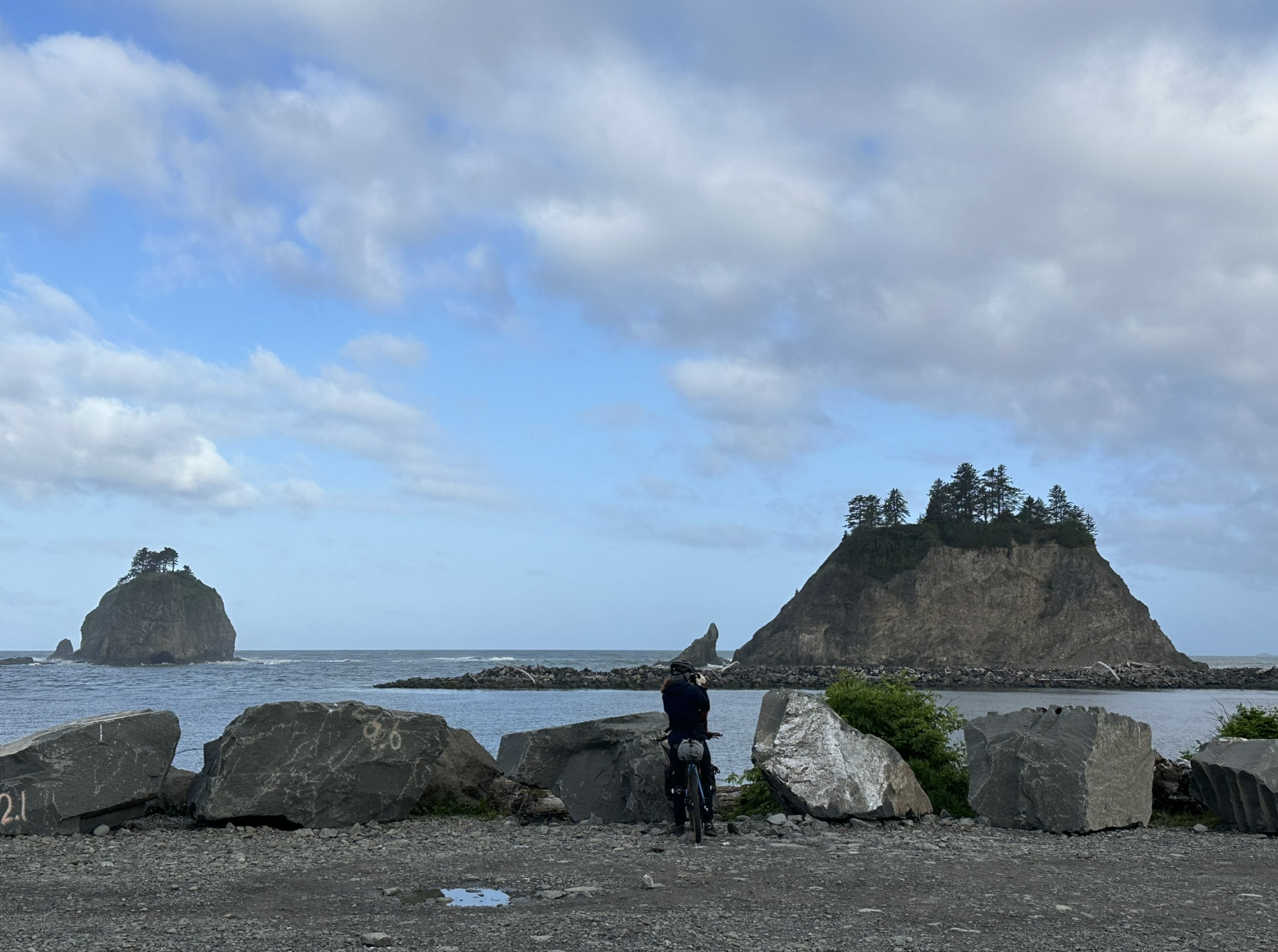
Kelly and I watched the village come to life and prepared to to begin our ride. A woman with long black hair opened a beachfront Tribal office. A bell sounded, and behind us the little Coast Guard station began another day. One guardsman raised the flag while his partner stood and saluted, his back stiff. At Native Grounds Coffee, we chatted with the bubbly proprietor and a pair of friendly ocean ecologists. We filled up our water bottles, and prepared to head right back up the hill we’d descended on the bus from Forks less than an hour before. Behind us rumbled the Pacific Ocean — huge, gray and sleepy in the morning. In imitation of other riders we’d seen on social media, we’d dipped the front tire of our bikes into the waves, feeling thankful for the unusual calm in this place of frequent and violent storms and a bit silly (and lucky) to be engaging in such a superstition.

Starting up the old road, we began our first few feet of real climb. The beautiful, modern Tribal school slid by, as did the trailheads to Second and Third beaches. Finally leaving all of La Push behind, we hit the open road and wound through clear cuts and forested hills as we approached the northern outskirts of Forks. Crossing US 101, we then slid onto a series of successively more rough gravel roads, which took us deep into the Callawah River drainage — a long, flat-bottomed forested valley — and then after about 10 miles up a steep drainage that led over 2000 foot ridge saddle to the north. At the top Kelly and I paused, sweaty in the cool air. There wasn’t much of a view since we were surrounded by higher foothills and mountains, but we treated it like a victory. We’d climbed our first “bump” of steep dirt and had already progressed from ocean to ridge top. It felt thrilling to be doing this again, doing this at all.

This herd of Elk did not love our zippy bicycles.

The descent was even better, and I may have whooped and hollered quite a bit while zipping, Star-Wars-speeder-bike style, through the massive tree trunks and down the rutted Forest Service track. The sky became gray but still rainless. In a large clear cut, we surprised a great herd of Roosevelt Elk, who rumbled away from our bikes, thankful that selection (natural or unnatural) had caused them to forget that they could have trampled us easily under hoof. We arrived at the northern valley bottom in a band of forest between the ridge we’d descended and highway 101. At this point we linked up with the Olympic Discovery Trail, a remote and rather astonishingly paved bikeway that parallels the highway in this remote area. After about 15 miles, we crossed the highway and entered a fun maze of single track trails which sloped down some 15 more miles toward Lake Crescent, our destination for the night.

According to Clallam Legend (the Clallam being a sister people to the Quileute, kin but also rivals) Lake Crescent and its smaller, shallower neighbor Lake Sutherland were severed from each other when the nearby mountain Tsulh-mut, called Storm King in English, became angry at fighting and slave-raiding between the related peoples. Breaking off a piece of his own peak/crown, Tsulh-mut hurled a massive foothill-sized boulder so as to sever both the lake and the two peoples’ territories. This legend’s basis in geological history has been confirmed by scientists who have shown that a massive landslide did indeed occur here in ancient times. So we know now that Tsulh-mut did split the lake, though whether or not he meant to, or whether this action produced any kind of detente between the Clallam and the Quileute is unknown.

Back on the Discovery Trail, we rounded the lake’s northern shore. Its surface was quite calm, a table top ruffled only by occasional movements of spring air. Hunting for a camping spot with minimal bugs and access to water was not the easiest task, but we eventually decided on a slim pebble beach, low and out of sight of the trail. I pumped and filtered water from the lake while Kelly fired up her stove. We ate and watched the sun descend over the lake. It was Friday, so the work week was ending leaving only the time of peace. The clouds flashed pale pink, blue, white-gray. I lit some candles. In the dark of my tent, I could feel the wind pick up off the severed lake. Through the cold night I felt the the massive, invisible body of Tsulh-mut towering nearby. If you pass this way I encourage you to stop even briefly to see and remember this mountain and its lake. Storm King, Tsulh-mut, great hatless king. He who long ago cast down his own crown for the sake of a now-haunted peace.

cycling

Bikepacking Adventure Across Washington

Welcome to a series of posts written during and just after a ride across the entire width of our home state of Washington. I undertook this adventure with my friend Kelly in May, 2024. Kelly and I, aside from working together, have always been connected by bikes. We first met on the autumn slopes of Park City Utah, after I’d just finished a somewhat epic ride from the PNW to that state to coincide with a work event. For some reason, I’d decided that long distance road touring qualified me to do some difficult single-track mountain biking, despite a near total lack of experience. A very large boulder and a sharp turn disagreed, and I was rather seriously concussed. It was none other than Kelly who happened to be coming down the trail behind me and was able to scrape my long, awkward form from the trail and make sure that I was okay (I was — as much as I ever am.) She has been teaching me about biking, particularly non-road biking and cool gear, and riding with me on and off ever since.

Without further ado, here’s a list of the posts that make up this story. Below, I’ll include some information about our route and gear.

Gear

Kelly and I are bikepacking on this trip — a stype of bike touring so named because it combines light weight touring, mountain biking and riding in remote and beautiful areas. We use a single bike for all types of terrain, ranging from pavement to gravel to some single-track. Bikepacking has a long history. Indeed, some of the earliest bicycles were built to contend with the rough roads of the time, and bicycles have a long history of military application in mountainous regions, particularly in Europe. But the last of Europe’s bicycle brigades was disbanded in 2003, and in recent decades, too, recreational biking has become ever more specialized, focusing on certain types of terrain: cyclocross, gravel, sand, even snow commuting, not to mention the ever-more (often uselessly) specialized and minimized road bikes.

By contrast, our equipment on this trip is designed to be able to handle anything: road/pavement, dirt roads, rough gravel and some trail and completely off-road riding. Here are our particular setups:

Kelly rides a Soma Wolverine frameset … her drivetrain is a bit of mystery to me, though I know it’s a 1×8 like mine, and that she, like me, would have preferred an additional climbing gear. Her brakes are hydraulic and rather high-end. Her headset features swept-back flat bars that despite their no-drop, provide a variety of hand positions. Her gear lives in two mini-front-panniers, a dry bag from mountain laurel designs mounted on a rear rack and a full custom back from Rockgeist. Especially to people who know more about mechanics and components than I do, her rig is a complete head-turner.

My own bike is an enormous Salsa Fargo gravel/touring frame. It’s basically a massive steel mountain bike with some carbon and no shocks, but set up with a dropped headset for long touring. I have a 1×8 drive train and mechanically regulated disk breaks. For packing I use an excellent stem bag and full frame bag, both from Revelate. Two fork-mounted everything-cages allow me to carry stuff up front, and I have two stem-mounted bags for water and immediate needs. My pad and was lashed to my headset old-school with two small bungees.

Both kelly and I use the GPS-enabled Wahoo Element Bolt computer for navigation, its accompanying app (excellent) and Ride with GPS for route editing and wrangling. The Wahoo Bolt proved to be the perfect computer for this (or any) tour, and once we got the hang of getting route information from Ride With GPS to the Bolt, route planning and navigation were reliable the entire way.

Route

Our purpose on this trip was to follow the XWA route across the entire state of Washington. The route, invented by an energetic bikepacker named Troy, begins on the Pacific coast at La Push, WA, and snakes its way west to east across the state from the rainforests and mountains of the Olympic Penninsula, through the Puget Sound region, across the mountains to the Columbia Basin and then up the arid slope and into Eastern Washington and the vast Palouse.

The route is … challenging. On digital paper, it features something like 40,000 feet of total climbing across 690 miles, and is about 80% off-road. There are significant portions of difficult terrain, particularly between Ellensburg and the Columbia, and also some portions of high elevation. In general, it seems to be designed to maximize time on remote and off-road routes, and encourage use of non-motorized trails and roads. While all of this was … er … interesting to us, and while we were certainly up for a challenge, we ended up following, at least after the first few days, a “light” version of the route that trimmed out some of the most technical and extreme portions of the route and made allowances for continued snow coverage, which was an issue at this time in May. The XWA uses several of Washington’s marvelous public trails, including the Cascades-to-Palouse, a semi-maintained route that follows the route of the former Milwaukee Railroad, now transformed into a (very long and snake-y) state park. This route and trip would not be possible without this amazing public resource.

Time and Preparation

We prepared for this adventure! A bunch of weekends out in the mountains and Islands getting our bodies ready, careful gear and bike preparation, ensuring that we had enough uninterrupted time, figuring out how best to get out to La Push and back home from Eastern Washington — all of this took work.

We decided (for relationship reasons, and the principle of it) to not ask for rides from loved ones, but to get to the beginning and the end of this adventure on public transportation. And so we began by taking a ferry from downtown Seattle, then a bus to Port Angeles. We arrived at the transit center in that wind-swept town just as the car ferry from Canada pulled in. Oddly, there had been some kind of a vehicle fire on the ferry, which meant that we found the little port choked with emergency vehicles from all around the region. We ate a hamburger and watched the chaos of or a bit, but then continued on our second bus ride of the day, which took us through the varied forests, clearcuts and slopes through which our ride would take us over the next day or so. We spent the night in the town of Forks, and then took one final morning bus (much praise, Clallam Transit for your excellent rural service) along with several Native American school kids on their morning commute to the tribal school in La Push. The wild Pacific peeked into view, more tranquil than usual under an even stranger (for this part of the world) blue sky. We were ready to start!